Monument Peak Copper-Silver-Gold Project - Idaho, USA
-
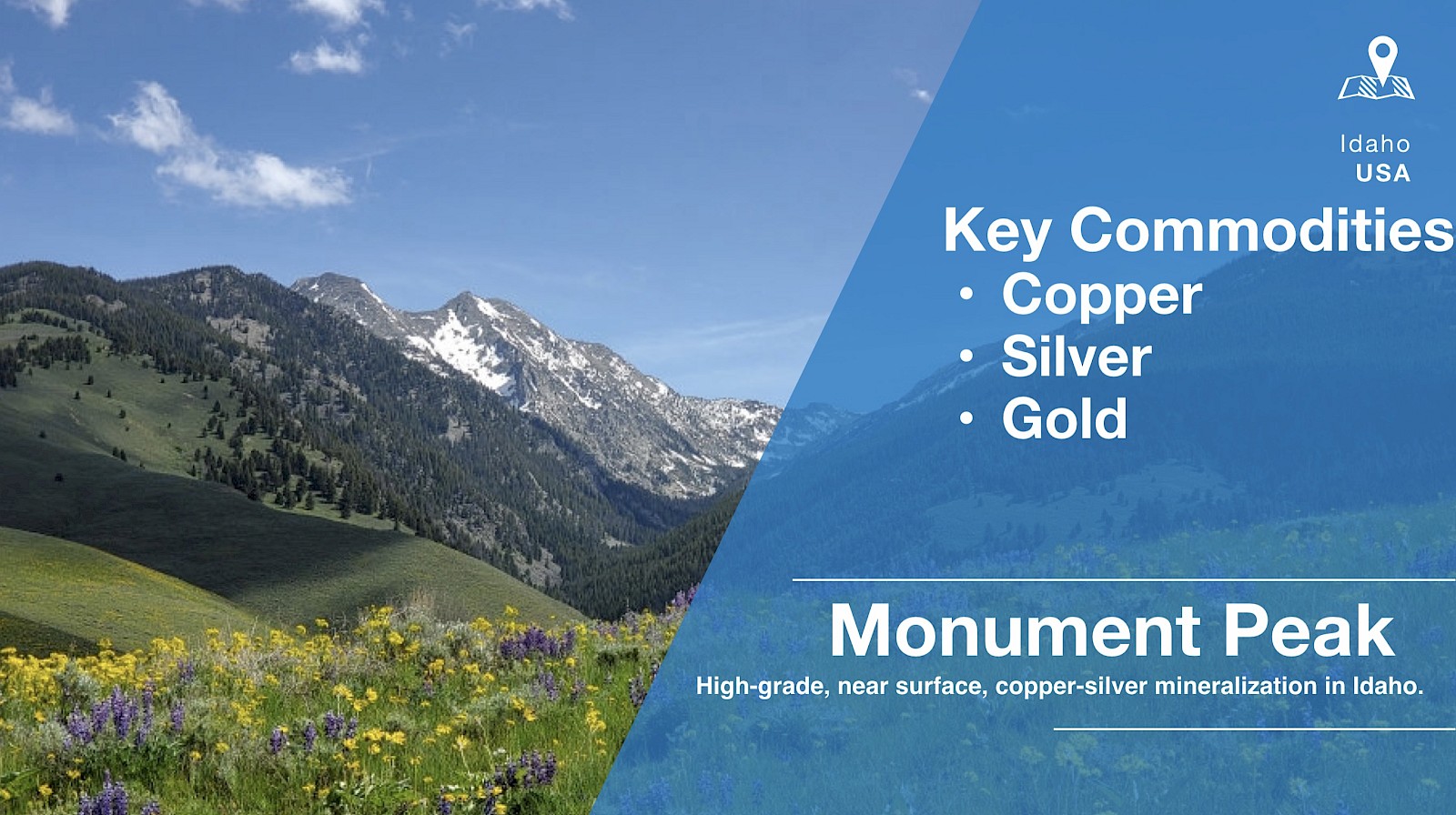
The Monument Peak Project is comprised of two separate claim blocks of contiguous, unpatented lode mining claims (“mineral tenures” or “claims”), totalling 84 claims and 689.77 ha. It is an exploration-staged, high-grade, copper-silver-gold project, which covers two small past producing copper mines: Jackson and Hungry Hill. Sporadic development and production in the area occurred primarily during the early 1900’s, with some additional development in the 1950’s. The most recent exploration occurred during the 1970’s and 1980’s.
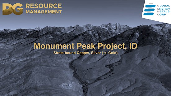
Click Here for a Presentation on the Monument Peak Project
On March 19, 2021, GEMC signed a Purchase Agreement (“the Agreement”) with DG Resource Management (US) Ltd. (“DGRM”), to acquire 50% interest in a portfolio of properties in Canada and the USA, including the Monument Peak Property.
Mitchel (1972) described the Cu-Ag-Au mineralization at Monument as having “unusual continuity” in association with structural zones within sericitic quartzites, which can be traced along 3,200 m strike that vary from 3 to 6 m width.
The mineralization is described (Lavery, 1988) as “syngenetic and fits a volcanic-hosted (massive) sulfide model … where … the copper-mineralized section might be as much as 175 feet thick”.
Project highlights follow (from North to South):
- North Showing: grab samples to 0.57% Cu, 248 g/t Ag, 57.5 g/t Au;
- Jackson Adit: grab samples to 13.6% Cu, 2,589 g/t Ag, 17.1 g/t Au;
- Chip Sample: 3.0 m of 7.03% Cu, 109 g/t Ag
- Chip Sample: 1.8 m of 3.11% Cu, 101 g/t Ag
- Chip Sample: 6.1 m of 4.32% Cu, 99 g/t Ag
- Anderson Occurrence: grab samples to 3.9% Cu, 89 g/t Ag, 2.5 g/t Au.
- Hungry Hill Mine (2 km east of main trend): 2.4 m of 17% Cu.
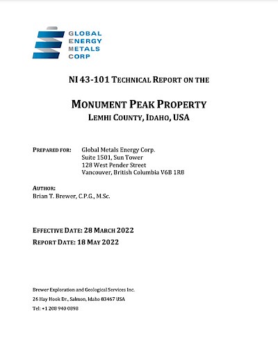
Click Here for the NI 43-101 Report on the Monument Peak Project
In 2020, DGRM conducted exploration on the Property with a focus on locating and sampling the historical workings and prospects to confirm the occurrence of significant Cu-Ag+/-Au mineralization. DGRM collected a total of 56 grab samples from quartz veins and metasediments that exhibited copper oxide staining, malachite, bornite, chrysocolla and/or sphalerite. Analytical results from the rock samples confirmed that Cu-Ag+/-Au mineralization occurs along a 3 km northwest-southeast trend and that the 2020 results are consistent with historical results at four main showings (Jackson, Hungry Hill, Anderson and North Showing). Samples with significant analytical results ranged from 1 to 20.9% Cu with 3.4 to 305 g/t Ag.
In 2021, GEMC contracted Dahrouge Geological Consulting USA Ltd. (“DGC”) to conduct geochemical rock and soil sampling on the Property. Results from the 2021 exploration program confirmed the occurrence of Cu-Ag+/-Au mineralization of significance along a northwest-southeast trend on the Property. Mineralization occurs for 3.2 km along a shear zone paralleling the quartzite contact and in fissure veins parallel and perpendicular to bedding.
Analytical results from these samples confirm significant Cu-Ag+/-Au mineralization along trend and are summarized in Table 1.
Results include sample 15140 with 5.61% Cu and 42.8 g/t Ag, sample 151402 with 2.76% Cu and 20.1 g/t Ag, Sample 151408 with 4.63% Cu, 17.40 g/t Au and 175 g/t Ag, and sample 151410 with 4.93% Cu, 17.60 g/t Au and 87.8 g/t Ag. For additional details please refer to news releases dated March 23, 2022 and September 9, 2021.
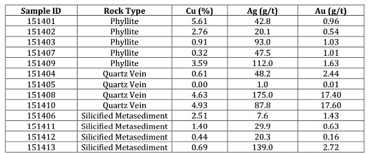
Table 1. Summary of 2021 Rock Sample Results
Technical Report Recommendations
A two-phase exploration strategy has been recommended.Phase 1 consists of:
- completion of an airborne high resolution magnetic survey and LiDAR survey over the entire Property.
- detailed geologic mapping, infill geochemical soil sampling and geochemical rock sampling of anomalies identified from the airborne survey.
- permitting for a diamond drill program and securing vehicle access to the Property through patented lands.
- cost of Phase 1 estimated to be USD $193,760.
Phase 2 consists of:
- diamond drill program to test targets identified to further delineate and better understand the geology, structure, mineralization, and geochemical characteristics on the Property at depth.
- cost of Phase 2 estimated to be USD $642,500.
The Technical Report is available for download under the Company's profile on SEDAR (www.sedar.com). A copy of the Technical Report is also located on the Company's website.
Quality assurance/quality control
All rock samples collected (grab) as well as quartz blanks and certified reference materials were shipped by ground to Activation Laboratories Ltd. in Kamloops, B.C., for multi-element analysis (including silver) by aqua regia digestion with ICP-OES finish (code 1E3) and gold analysis by fire assay with AA finish (package 1A2B-50). Over-limit results for gold, silver, copper, lead and zinc were determined by the relevant analytical package.Management cautions that prospecting surface rock sample assays, as presented herein, are selective by nature and represent a point location and therefore may not necessarily be fully representative of the mineralized horizon sampled.
Qualified Persons
Jody Dahrouge, BSc, P. Geo., President of DG Resource Management and a qualified person as defined by NI 43-101, supervised the preparation of the technical information in this news release.Mr. Paul Sarjeant, P. Geo., is the qualified person for this release as defined by National Instrument 43-101 - Standards of Disclosure for Mineral Projects.